
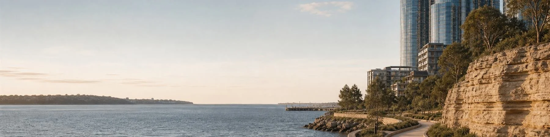
Barangaroo Waterfront: Urban Renewal
A contemporary waterfront walk from Barangaroo Metro Station to King Street Wharf/Darling Harbour
Short Introduction
This walk reads Barangaroo as a contemporary urban renewal precinct rather than only a scenic waterfront.
Starting at Barangaroo Metro Station, the route moves through transport infrastructure, cultural event space, luxury architecture, waterfront access, corporate office space, hospitality venues, public promenades and harbour-facing redevelopment.
It asks how Sydney’s western harbour edge has been remade through design, infrastructure, private capital and public space — and what changes when a former working-industrial waterfront becomes a place of leisure, prestige and investment.
Walk Snapshot
Start
Barangaroo Metro Station
Finish
King Street Wharf/Darling Harbour
Main Route
Barangaroo Metro Station → The Cutaway / Wellama → Crown Sydney / One Sydney Harbour → Watermans Cove / Hickson Park → International Towers / Barangaroo Avenue → Barangaroo House / Wulugul Walk → King Street Wharf → Darling Harbour
Access Note
The main route is mostly paved and compact. The Barangaroo Reserve / Marrinawi Cove extension adds more distance and may involve slopes, stairs or uneven surfaces depending on the path chosen.
-
What to notice
Start at the metro entrance on Hickson Road. Notice how quickly the station places you inside the waterfront precinct.Look at the new materials, passenger flow and the way transport now frames the arrival experience.
Why it matters
Opened as part of Sydney Metro’s city section in 2024, Barangaroo Station changes how people arrive at this once harder-to-reach western edge of the CBD.Transport does not only move people. It creates new walking habits and changes which parts of the city feel close, central or accessible.
Question to carry
How does new transport create new walking habits? -
What to notice
Move toward The Cutaway below the eastern edge of Barangaroo Reserve. Read the large interior volume, sandstone edge, entrance sequence and relationship between underground space and the parkland above.If visible, pause at Wellama near the Cutaway and read it as a welcome to Country through sound, image, movement and public space.
Why it matters
The Cutaway shows that public landscape can also contain cultural and event infrastructure. A park is not only grass, paths and views; it can also hold performance, exhibition, gathering and civic branding.This is a short opening stop rather than a full Barangaroo Reserve walk. It introduces the route’s questions about transport, Country, public space, culture and redevelopment without pulling the main route too far north.
Question to carry
How does a park become a cultural venue? -
What to notice
From The Cutaway, continue south toward Crown Sydney and One Sydney Harbour. Read them together as a vertical cluster of luxury architecture, hotel space, residences and harbour views.Look up at the height, curved forms, glass surfaces, entrances and the way these buildings frame the waterfront precinct.
Why it matters
This is where Barangaroo’s relationship between architecture, capital and view becomes most visible.Crown Sydney makes private capital visible in the skyline. One Sydney Harbour represents the globalised luxury-residential face of Barangaroo. Together, they show how harbour views, architectural branding and investment value are tied together.
Whether visitors like or dislike these buildings, they have become part of how contemporary Sydney is visually recognised.
Question to carry
How does architecture turn a view into an asset? -
What to notice
Continue toward Watermans Cove and the surrounding public space. Read the water steps, seating, open water, planted areas and the relationship between the cove and surrounding towers.Notice who is using the space and how the design invites sitting, photographing, meeting and lingering.
Why it matters
Watermans Cove makes the tension between public access and high-value development easy to see.It is both a public pause point and a real estate setting. That does not make it fake, but it does make it worth reading carefully.
This stop is important because it keeps the route from becoming only about skyline buildings. It asks how public space works inside a luxury redevelopment precinct.
Question to carry
Who benefits from waterfront public space? -
What to notice
Walk through the office-tower precinct and read lobbies, lunch crowds, street trees, retail frontages and corporate scale.Notice how the atmosphere changes between work hours, evenings and weekends.
Why it matters
International Towers extend the CBD westward. They show Barangaroo not only as leisure waterfront, but as a finance and professional-services district.This stop is important because the precinct is not only for tourists or residents. It is also a workplace.
Question to carry
How does office work reshape the waterfront? -
What to notice
Return to the water and follow Wulugul Walk past Barangaroo House, restaurants, harbour seating and evening light.Notice the shift from office precinct to dining, leisure and waterfront lifestyle.
Why it matters
Wulugul Walk turns urban renewal into everyday experience: walking, waiting, dining, photographing, meeting friends and moving toward Darling Harbour.Barangaroo House is useful here because it shows how architecture, hospitality and waterfront branding work together. The building is not only a restaurant destination; it helps stage the precinct as a place for leisure and lifestyle.
Question to carry
How does urban renewal become a lifestyle experience? -
What to notice
Continue south toward King Street Wharf. Notice the change in atmosphere from the newer Barangaroo precinct into a more established waterfront dining and ferry area.Look at restaurants, wharf edges, water movement, evening crowds and the way people wait, meet, dine and move through the harbour edge.
Why it matters
King Street Wharf helps show that Barangaroo does not stand alone. It connects into a longer western waterfront shaped by dining, ferries, office workers, visitors and harbour leisure.This stop makes the route feel less like a single precinct tour and more like part of Sydney’s broader waterfront economy.
Question to carry
How does one waterfront precinct connect to another? -
What to notice
Finish by moving toward Darling Harbour. Look back toward Barangaroo and notice the transition from corporate towers and new waterfront promenades into the older entertainment and tourism landscape of Darling Harbour.Read the end point as a shift in waterfront identity: from prestige renewal to everyday leisure, restaurants, ferries, crowds and visitor movement.
Why it matters
Ending here makes the route feel complete. It shows how Barangaroo connects to a broader western harbour edge rather than standing alone.The final stretch helps visitors see contemporary Sydney as a chain of waterfront experiences: transport, cultural infrastructure, luxury development, public space, corporate work, dining and harbour leisure.
Question to carry
How does one waterfront precinct change the way we read the next one? -
Barangaroo Reserve / Marrinawi Cove
What to notice
If you want a longer landscape-focused version, add Barangaroo Reserve and Marrinawi Cove as a separate extension.Read the sandstone foreshore, curved paths, planting, harbour views and public access to the water. Marrinawi Cove adds another layer: the harbour becomes a place to enter, not only a view to look at.
Why it matters
Barangaroo Reserve is important, but it changes the rhythm of the walk. It creates a longer northern landscape loop rather than a short-interval waterfront route.For this reason, it works best as an optional extension. It gives the route a stronger landscape and harbour-access layer, but it should not be confused with the main no-backtracking route.
Question to carry
What changes when the harbour becomes a place to enter, not only a view to look at?
Before You Begin
This route is located on Gadigal Country.
Barangaroo is named after Barangaroo, a powerful Cammeraygal woman known through early colonial records. The precinct’s contemporary naming, design and public interpretation sit within broader questions about Aboriginal presence, representation and urban redevelopment.
This walk focuses on the modern waterfront redevelopment, but the area should not be read as an empty site before renewal. It has longer histories of Country, harbour, fishing, labour, industry, infrastructure and politics.
Why This Walk Matters
Barangaroo is one of the clearest places to read contemporary Sydney.
It combines a new metro station, cultural and event infrastructure, high-value apartments, corporate office towers, restaurants, waterfront promenades, public spaces and harbour branding.
This route is useful because it makes urban renewal visible. It asks who the waterfront is for, how public space supports private development, and how a former working-industrial edge becomes a landscape of leisure, prestige and investment.
The walk is easy and scenic, but the questions underneath it are not simple.
Route Logic and Interpretive Structure
This walk is designed as a compact, mostly one-way southbound route, with short intervals between the main stops.
Barangaroo Metro Station → The Cutaway / Wellama → Crown Sydney / One Sydney Harbour → Watermans Cove / Hickson Park → International Towers / Barangaroo Avenue → Barangaroo House / Wulugul Walk → King Street Wharf → Darling Harbour.
The route reads Barangaroo through three layers: infrastructure and cultural programming, private capital and waterfront access, and workplace-to-leisure urban life.
The Cutaway works best as a short opening stop near Barangaroo Metro Station. Crown Sydney and One Sydney Harbour make the relationship between architecture, capital and harbour views visible. Watermans Cove and Wulugul Walk bring the route back to questions of public access, sitting, walking and everyday use.
International Towers, Barangaroo Avenue, Barangaroo House and King Street Wharf show how the precinct shifts from corporate work to hospitality, leisure and harbour-facing public life.
A full walk through Barangaroo Reserve or Marrinawi Cove should be treated as an optional landscape extension, not part of the main route.
STOPS
Access and Planning Notes
This walk is designed as a cultural reading route rather than a waterfront dining itinerary.
Public pause points may be available around Barangaroo South, Wulugul Walk, Barangaroo House, King Street Wharf, Darling Harbour and Barangaroo Reserve if using the optional extension, depending on opening hours and access conditions.
Some areas may be affected by construction, events, venue access, waterfront maintenance or temporary closures. Check current access information before relying on interior visits, event spaces, swimming access or specific waterfront routes.
For a slower version, spend more time around Watermans Cove, Wulugul Walk or King Street Wharf. For a landscape-focused version, add Barangaroo Reserve and Marrinawi Cove as a separate extension.
Suggested Sources and Further Reading
Barangaroo
https://www.barangaroo.com/The Cutaway
https://www.barangaroo.com/past-present-future/barangaroo-reserve/the-cutaway-projectBarangaroo Reserve
https://www.barangaroo.com/precincts/barangaroo-reserveMarrinawi Cove
https://www.barangaroo.com/see-do-stay/swim-at-marrinawi-coveWulugul Walk
https://www.internationaltowers.com/news/wulugul-walkOne Sydney Harbour
https://www.rpbw.com/project/one-sydney-harbourCrown Sydney
https://www.crownhotels.com.au/sydney/crown-towersInternational Towers Sydney
https://www.internationaltowers.com/